
Yateras topographic map
Interactive map
Click on the map to display elevation.
About this map
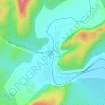
Name: Yateras topographic map, elevation, terrain.
Location: Yateras, San Antonio del Sur, Guantánamo, Cuba (20.01082 -75.03272 20.01759 -75.03226)
Average elevation: 58 m
Minimum elevation: 22 m
Maximum elevation: 154 m
Other topographic maps
Click on a map to view its topography, its elevation and its terrain.
Yateras
Cuba > Guantánamo > Yateras > Felicidad de Yateras
Yateras, Felicidad de Yateras, Yateras, Guantánamo, Cuba
Average elevation: 558 m
Yateras
Cuba > Guantánamo > Yateras > Felicidad de Yateras
Yateras, Felicidad de Yateras, Yateras, Guantánamo, Cuba
Average elevation: 512 m
Baie de Guantánamo
Cuba > Guantánamo > Caimanera > Guantánamo
Baie de Guantánamo, Guantánamo, Caimanera, Guantánamo, Cuba
Average elevation: 22 m