
Raeren topographic map
Interactive map
Click on the map to display elevation.
About this map
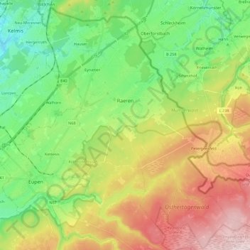
Name: Raeren topographic map, elevation, terrain.
Location: Raeren, Verviers, Liège, Wallonia, Belgium (50.60063 6.04036 50.72396 6.26231)
Average elevation: 338 m
Minimum elevation: 174 m
Maximum elevation: 597 m