
Kemptville topographic map
Interactive map
Click on the map to display elevation.
About this map
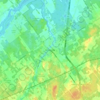
Name: Kemptville topographic map, elevation, terrain.
Average elevation: 97 m
Minimum elevation: 84 m
Maximum elevation: 117 m
Other topographic maps
Click on a map to view its topography, its elevation and its terrain.
North Grenville
Canada > Ontario > Leeds and Grenville Counties > North Grenville
North Grenville, Leeds and Grenville Counties, Eastern Ontario, Ontario, Canada
Average elevation: 98 m
Oxford Mills
Canada > Ontario > Leeds and Grenville Counties > North Grenville
Oxford Mills, North Grenville, Leeds and Grenville Counties, Eastern Ontario, Ontario, K0G 1S0, Canada
Average elevation: 103 m