
Muang Xay topographic map
Interactive map
Click on the map to display elevation.
About this map
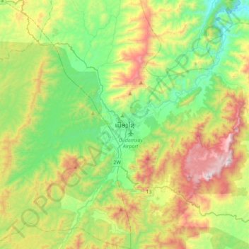
Name: Muang Xay topographic map, elevation, terrain.
Location: Muang Xay, Xay District, Oudomxay, 818, Laos (20.53301 101.82537 20.85301 102.14537)
Average elevation: 928 m
Minimum elevation: 455 m
Maximum elevation: 1,821 m
Oudomxay Province has a moderate monsoon climate. Due to its relatively high elevation, there are more variations in temperature during the year and a colder dry season in northern Laos than in the rest of the country.