
Boxtel topographic map
Interactive map
Click on the map to display elevation.
About this map
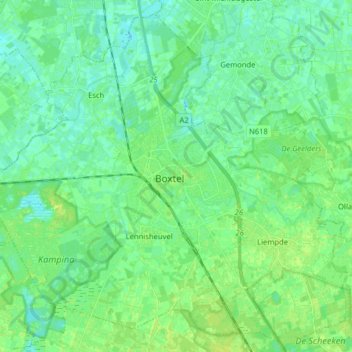
Name: Boxtel topographic map, elevation, terrain.
Location: Boxtel, North Brabant, Netherlands (51.54349 5.24618 51.63463 5.40520)
Average elevation: 8 m
Minimum elevation: 2 m
Maximum elevation: 15 m
Dutch topographic map of the municipality of Boxtel, 2021
Other topographic maps
Click on a map to view its topography, its elevation and its terrain.
's-Hertogenbosch
's-Hertogenbosch, North Brabant, Netherlands
Average elevation: 4 m
Hout
Netherlands > North Brabant > Geldrop
Hout, Geldrop, Geldrop-Mierlo, North Brabant, Netherlands, 5664 EW, Netherlands
Average elevation: 22 m
Helvoirt
Helvoirt, Vught, North Brabant, Netherlands
Average elevation: 7 m
Sint Anthonis
Sint Anthonis, Land van Cuijk, North Brabant, Netherlands
Average elevation: 18 m
Eindhoven
Netherlands > North Brabant > Eindhoven
Eindhoven, North Brabant, Netherlands, 5611EB, Netherlands
Average elevation: 21 m
Geertruidenberg
Geertruidenberg, North Brabant, Netherlands
Average elevation: 2 m
Roosendaal
Netherlands > North Brabant > Roosendaal
Roosendaal, North Brabant, Netherlands
Average elevation: 5 m
Eerde
Netherlands > North Brabant > Eerde
Eerde, North Brabant, Netherlands, 5466, Netherlands
Average elevation: 11 m
Helmond
Netherlands > North Brabant > Helmond
Helmond, North Brabant, Netherlands
Average elevation: 20 m
Driehoek
Netherlands > North Brabant > Driehoek
Driehoek, North Brabant, Netherlands, 5691NE, Netherlands
Average elevation: 16 m
Geertruidenberg
Netherlands > North Brabant > Geertruidenberg
Geertruidenberg, North Brabant, Netherlands
Average elevation: 2 m
Sint Anthonis
Sint Anthonis, North Brabant, Netherlands
Average elevation: 19 m
Tilburg
Netherlands > North Brabant > Tilburg
Tilburg, North Brabant, Netherlands
Average elevation: 12 m
Eindhoven
Netherlands > North Brabant > Eindhoven
Eindhoven, North Brabant, Netherlands
Average elevation: 20 m
Raamsdonksveer
Netherlands > North Brabant > Geertruidenberg
Raamsdonksveer, Geertruidenberg, North Brabant, Netherlands
Average elevation: 2 m