
Cap-Rouge topographic map
Interactive map
Click on the map to display elevation.
About this map
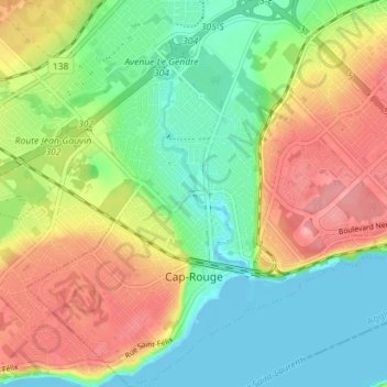
Name: Cap-Rouge topographic map, elevation, terrain.
Average elevation: 39 m
Minimum elevation: -5 m
Maximum elevation: 92 m
Other topographic maps
Click on a map to view its topography, its elevation and its terrain.
Sainte-Foy–Sillery–Cap-Rouge
Canada > Quebec > Sainte-Foy–Sillery–Cap-Rouge
Sainte-Foy–Sillery–Cap-Rouge, Québec (Agglomération), Capitale-Nationale, Quebec, Canada
Average elevation: 67 m