
Castleton topographic map
Interactive map
Click on the map to display elevation.
About this map
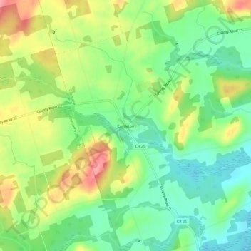
Name: Castleton topographic map, elevation, terrain.
Average elevation: 200 m
Minimum elevation: 161 m
Maximum elevation: 256 m
Other topographic maps
Click on a map to view its topography, its elevation and its terrain.
Colborne
Canada > Ontario > Northumberland County > Cramahe
Colborne, Cramahe, Northumberland County, Central Ontario, Ontario, K0K 1S0, Canada
Average elevation: 114 m