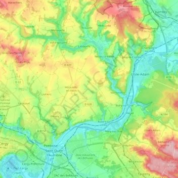
Saint-Ouen-l'Aumône topographic map
Interactive map
Click on the map to display elevation.
About this map
Name: Saint-Ouen-l'Aumône topographic map, elevation, terrain.
Average elevation: 84 m
Minimum elevation: 19 m
Maximum elevation: 196 m

Click on the map to display elevation.
Name: Saint-Ouen-l'Aumône topographic map, elevation, terrain.
Average elevation: 84 m
Minimum elevation: 19 m
Maximum elevation: 196 m