
Campomanes topographic map
Interactive map
Click on the map to display elevation.
About this map
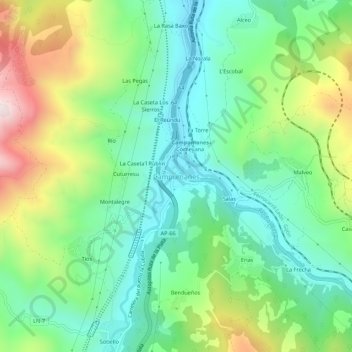
Name: Campomanes topographic map, elevation, terrain.
Location: Campomanes, Asturias, 33620, España (43.08542 -5.83856 43.12542 -5.79856)
Average elevation: 595 m
Minimum elevation: 347 m
Maximum elevation: 1,103 m