
Montrose topographic map
Interactive map
Click on the map to display elevation.
About this map
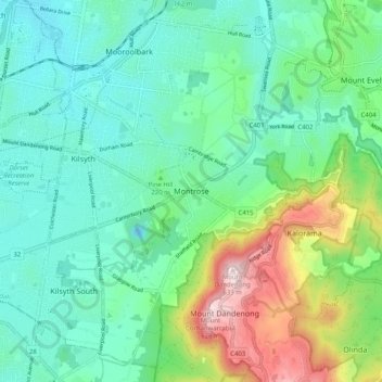
Name: Montrose topographic map, elevation, terrain.
Location: Montrose, Shire of Yarra Ranges, Victoria, 3765, Australia (-37.85062 145.30215 -37.77062 145.38215)
Average elevation: 211 m
Minimum elevation: 67 m
Maximum elevation: 621 m
Other topographic maps
Click on a map to view its topography, its elevation and its terrain.
Dandenong Ranges National Park - Ferntree Gully
Australia > Victoria > Montrose
Dandenong Ranges National Park - Ferntree Gully, Bradley Track, Olinda, Montrose, Shire of Yarra Ranges, Victoria, 3765, Australia
Average elevation: 345 m