
Noatak topographic map
Interactive map
Click on the map to display elevation.
About this map
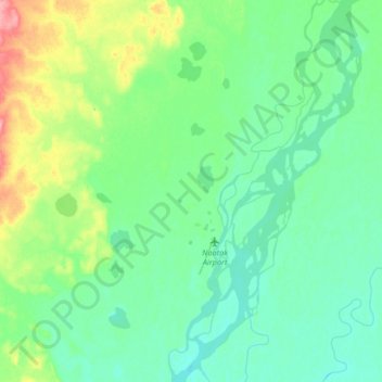
Name: Noatak topographic map, elevation, terrain.
Location: Noatak, Northwest Arctic, Alaska, United States (67.52037 -163.25985 67.64493 -162.93130)
Average elevation: 31 m
Minimum elevation: 12 m
Maximum elevation: 98 m
Other topographic maps
Click on a map to view its topography, its elevation and its terrain.
Chicago Creek
United States > Alaska > Northwest Arctic > Chicago Creek
Chicago Creek, Northwest Arctic, Alaska, United States
Average elevation: 54 m