
Raspberry topographic map
Interactive map
Click on the map to display elevation.
About this map
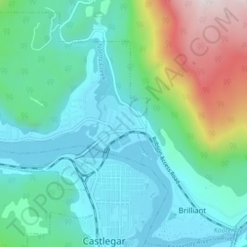
Name: Raspberry topographic map, elevation, terrain.
Average elevation: 651 m
Minimum elevation: 414 m
Maximum elevation: 1,450 m
Other topographic maps
Click on a map to view its topography, its elevation and its terrain.
Bentz Peak
Canada > British Columbia > Regional District of Central Kootenay > Area J (Lower Arrow/Columbia)
Bentz Peak, Area J (Lower Arrow/Columbia), Regional District of Central Kootenay, British Columbia, Canada
Average elevation: 2,037 m