
Deganwy topographic map
Interactive map
Click on the map to display elevation.
About this map
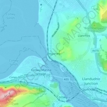
Name: Deganwy topographic map, elevation, terrain.
Location: Deganwy, Conwy, Wales, LL31 9QH, United Kingdom (53.27743 -3.85393 53.31743 -3.81393)
Average elevation: 25 m
Minimum elevation: 0 m
Maximum elevation: 240 m