
Barranco topographic map
Interactive map
Click on the map to display elevation.
About this map
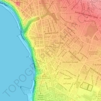
Name: Barranco topographic map, elevation, terrain.
Average elevation: 55 m
Minimum elevation: 0 m
Maximum elevation: 101 m
The name Barranco (Spanish for ravine) is descriptive of its topography, featuring homes and restaurants in and around a ravine near a cliff overlooking a sand strip which runs from the Miraflores District to Chorrillos (now flanked by a highway, Costa Verde Ave.).