
Ashdod topographic map
Interactive map
Click on the map to display elevation.
About this map
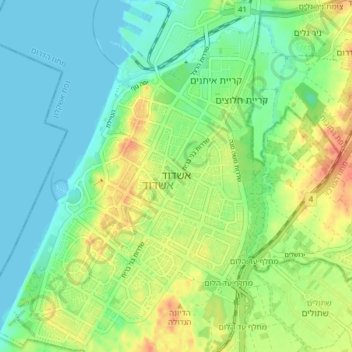
Name: Ashdod topographic map, elevation, terrain.
Location: Ashdod, South District, Israel (31.76462 34.61746 31.83052 34.67459)
Average elevation: 18 m
Minimum elevation: -1 m
Maximum elevation: 48 m
Other topographic maps
Click on a map to view its topography, its elevation and its terrain.
Ashdod
Israel > South District > Ashdod
Ashdod, Ashkelon Subdistrict, South District, Israel
Average elevation: 17 m