
Percy Lake topographic map
Interactive map
Click on the map to display elevation.
About this map
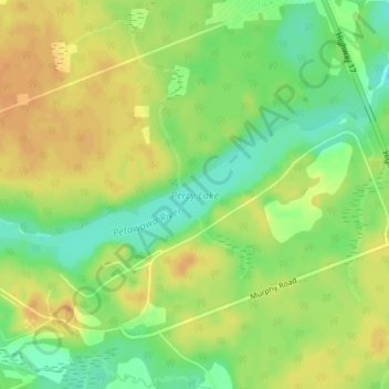
Name: Percy Lake topographic map, elevation, terrain.
Average elevation: 153 m
Minimum elevation: 134 m
Maximum elevation: 168 m
Other topographic maps
Click on a map to view its topography, its elevation and its terrain.
Brennan Lake
Brennan Lake, Paquette Road, CFB Petawawa, Petawawa, Renfrew County, Eastern Ontario, Ontario, K8H 2Y1, Canada
Average elevation: 146 m