
South Somerset topographic map
Interactive map
Click on the map to display elevation.
About this map
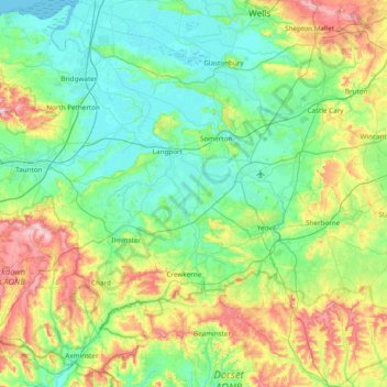
Name: South Somerset topographic map, elevation, terrain.
Average elevation: 83 m
Minimum elevation: -2 m
Maximum elevation: 328 m
Other topographic maps
Click on a map to view its topography, its elevation and its terrain.
Dorset
United Kingdom > England > South Somerset > Talbot Village
Dorset, Wood Drove, Huish Episcopi, South Somerset, Somerset, South West England, England, TA10 0DD, United Kingdom
Average elevation: 57 m