
Dearing topographic map
Interactive map
Click on the map to display elevation.
About this map
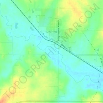
Name: Dearing topographic map, elevation, terrain.
Location: Dearing, Montgomery County, Kansas, 67340, United States (37.04096 -95.71965 37.06375 -95.67887)
Average elevation: 238 m
Minimum elevation: 223 m
Maximum elevation: 264 m
Other topographic maps
Click on a map to view its topography, its elevation and its terrain.
Coffeyville
United States > Kansas > Montgomery County
Coffeyville, Montgomery County, Kansas, 67337, United States
Average elevation: 229 m