
Lunenburg topographic map
Interactive map
Click on the map to display elevation.
About this map
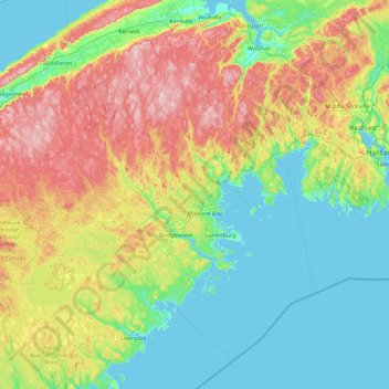
Name: Lunenburg topographic map, elevation, terrain.
Location: Lunenburg, Lunenburg County, Nova Scotia, Canada (43.80703 -65.13446 45.20703 -63.73446)
Average elevation: 73 m
Minimum elevation: -3 m
Maximum elevation: 284 m