
Cobalt topographic map
Interactive map
Click on the map to display elevation.
About this map
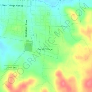
Name: Cobalt topographic map, elevation, terrain.
Location: Cobalt, Madison County, Missouri, United States (37.54231 -90.29300 37.54957 -90.28238)
Average elevation: 244 m
Minimum elevation: 214 m
Maximum elevation: 285 m
Other topographic maps
Click on a map to view its topography, its elevation and its terrain.
Fredericktown
United States > Missouri > Madison County
Fredericktown, Madison County, Missouri, 63645, United States
Average elevation: 234 m