
Casanare topographic map
Interactive map
Click on the map to display elevation.
About this map
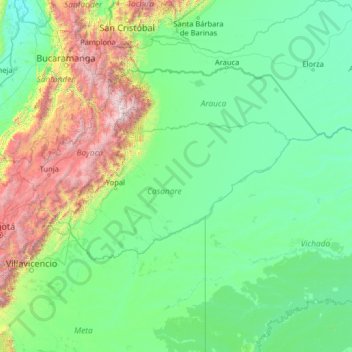
Name: Casanare topographic map, elevation, terrain.
Location: Casanare, Colombia (2.94001 -74.06001 8.06001 -68.94001)
Average elevation: 592 m
Minimum elevation: 39 m
Maximum elevation: 5,088 m
Other topographic maps
Click on a map to view its topography, its elevation and its terrain.