
Mersin topographic map
Interactive map
Click on the map to display elevation.
About this map
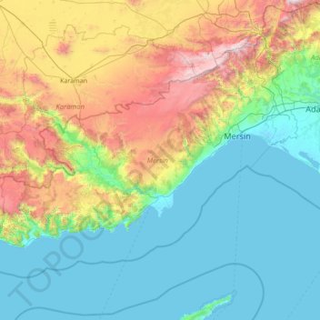
Name: Mersin topographic map, elevation, terrain.
Location: Mersin, Mediterranean Region, Turkey (35.81700 32.39510 37.43560 35.15165)
Average elevation: 685 m
Minimum elevation: -3 m
Maximum elevation: 3,473 m