
Kidepo Valley National Park topographic map
Interactive map
Click on the map to display elevation.
About this map
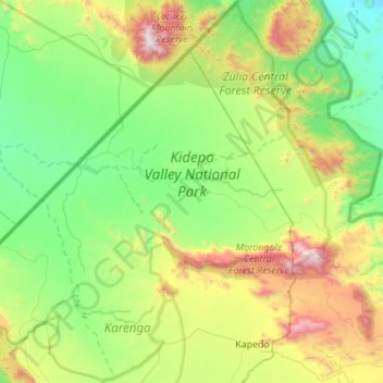
Name: Kidepo Valley National Park topographic map, elevation, terrain.
Location: Kidepo Valley National Park, Kaabong, Northern Region, Uganda (3.63260 33.51452 4.17338 34.06239)
Average elevation: 1,309 m
Minimum elevation: 788 m
Maximum elevation: 2,737 m
Other topographic maps
Click on a map to view its topography, its elevation and its terrain.