
Marshalltown topographic map
Interactive map
Click on the map to display elevation.
About this map
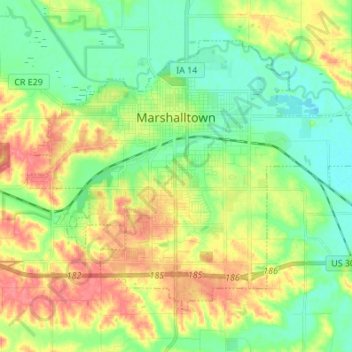
Name: Marshalltown topographic map, elevation, terrain.
Location: Marshalltown, Marshall County, Iowa, 50158, United States (41.99321 -92.96990 42.07101 -92.83389)
Average elevation: 283 m
Minimum elevation: 258 m
Maximum elevation: 319 m
Other topographic maps
Click on a map to view its topography, its elevation and its terrain.
Liscomb
United States > Iowa > Marshall County
Liscomb, Marshall County, Iowa, United States
Average elevation: 299 m