
Ashcroft topographic map
Interactive map
Click on the map to display elevation.
About this map
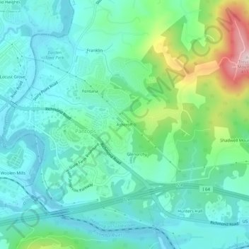
Name: Ashcroft topographic map, elevation, terrain.
Location: Ashcroft, Albemarle County, Virginia, 22909, USA (38.01125 -78.45584 38.05125 -78.41584)
Average elevation: 163 m
Minimum elevation: 88 m
Maximum elevation: 409 m