
Dinosaur Provincial Park topographic map
Interactive map
Click on the map to display elevation.
About this map
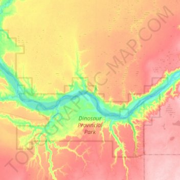
Name: Dinosaur Provincial Park topographic map, elevation, terrain.
Average elevation: 712 m
Minimum elevation: 625 m
Maximum elevation: 781 m
The park is situated in the valley of the Red Deer River, which is noted for its striking badland topography. The park is well known for being one of the richest dinosaur fossil locales in the world. Fifty-eight dinosaur species have been discovered at the park and more than 500 specimens have been removed and exhibited in museums around the globe. The renowned fossil assemblage of nearly 500 species of life, from microscopic fern spores to large carnivorous dinosaurs, justified its becoming a World Heritage Site in 1979.
Other topographic maps
Click on a map to view its topography, its elevation and its terrain.
Rock Lake
Canada > Alberta > County of Newell
Rock Lake, County of Newell, Alberta, Canada
Average elevation: 764 m