
Arkansas City topographic map
Interactive map
Click on the map to display elevation.
About this map
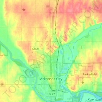
Name: Arkansas City topographic map, elevation, terrain.
Location: Arkansas City, Cowley County, Kansas, 67005, United States (37.03868 -97.06734 37.14163 -96.99984)
Average elevation: 345 m
Minimum elevation: 314 m
Maximum elevation: 378 m