
Wels topographic map
Interactive map
Click on the map to display elevation.
About this map
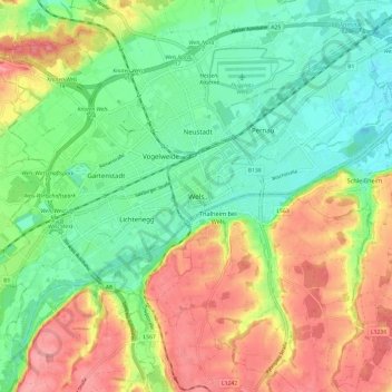
Name: Wels topographic map, elevation, terrain.
Location: Wels, Upper Austria, 4600, Austria (48.11655 13.98438 48.19655 14.06438)
Average elevation: 343 m
Minimum elevation: 301 m
Maximum elevation: 400 m
Other topographic maps
Click on a map to view its topography, its elevation and its terrain.