
Hammer a.d. Uecker topographic map
Interactive map
Click on the map to display elevation.
About this map
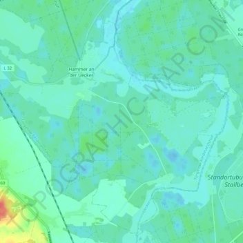
Name: Hammer a.d. Uecker topographic map, elevation, terrain.
Average elevation: 11 m
Minimum elevation: 2 m
Maximum elevation: 51 m
Other topographic maps
Click on a map to view its topography, its elevation and its terrain.
Greifswalder Oie
Germany > Mecklenburg-Vorpommern > Vorpommern-Greifswald > Kröslin
Greifswalder Oie, Kröslin, Lubmin, Vorpommern-Greifswald, Mecklenburg-Vorpommern, 17440, Germany
Average elevation: 0 m