
Fogo topographic map
Interactive map
Click on the map to display elevation.
About this map
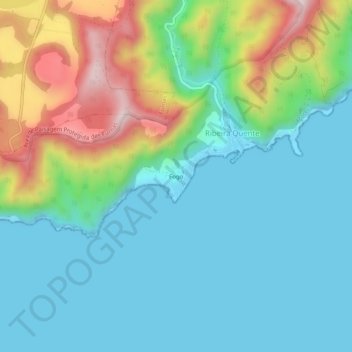
Name: Fogo topographic map, elevation, terrain.
Location: Fogo, Povoação, São Miguel, Azores, 9675-139, Portugal (37.71146 -25.32718 37.75146 -25.28718)
Average elevation: 125 m
Minimum elevation: -2 m
Maximum elevation: 471 m