
Bushehr topographic map
Interactive map
Click on the map to display elevation.
About this map
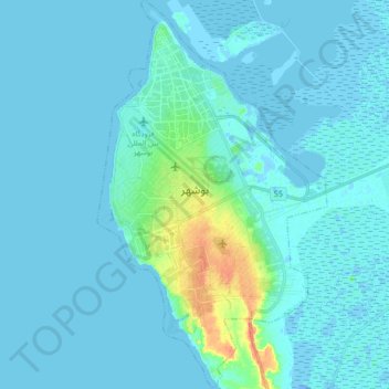
Name: Bushehr topographic map, elevation, terrain.
Average elevation: 5 m
Minimum elevation: -17 m
Maximum elevation: 43 m
Other topographic maps
Click on a map to view its topography, its elevation and its terrain.
Bushehr
Iran > Bushehr Province > Bushehr
Bushehr, Bakhsh-e-Markazi of Bushehr County, Bushehr County, Bushehr Province, 7518776863, Iran
Average elevation: 2 m