
Harringworth topographic map
Interactive map
Click on the map to display elevation.
About this map
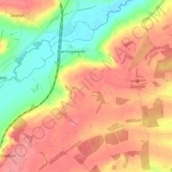
Name: Harringworth topographic map, elevation, terrain.
Average elevation: 83 m
Minimum elevation: 36 m
Maximum elevation: 117 m
Other topographic maps
Click on a map to view its topography, its elevation and its terrain.
East Northamptonshire
United Kingdom > England > East Northamptonshire
East Northamptonshire, Northamptonshire, East Midlands, England, United Kingdom
Average elevation: 63 m