
Faial Island topographic map
Interactive map
Click on the map to display elevation.
About this map
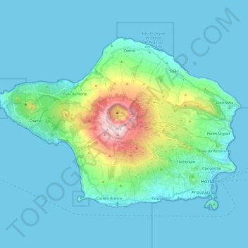
Name: Faial Island topographic map, elevation, terrain.
Location: Faial Island, Cedros, Horta, Faial, Azores, Portugal (38.51516 -28.83479 38.64409 -28.59811)
Average elevation: 134 m
Minimum elevation: 0 m
Maximum elevation: 1,044 m