
North Twin Island topographic map
Interactive map
Click on the map to display elevation.
About this map
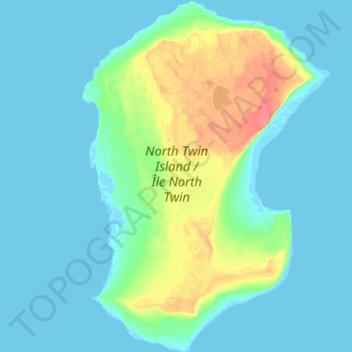
Name: North Twin Island topographic map, elevation, terrain.
Location: North Twin Island, NU, Canada (53.22482 -80.09791 53.39336 -79.89853)
Average elevation: 10 m
Minimum elevation: -2 m
Maximum elevation: 54 m
Other topographic maps
Click on a map to view its topography, its elevation and its terrain.