
Kitselas Canyon topographic map
Interactive map
Click on the map to display elevation.
About this map
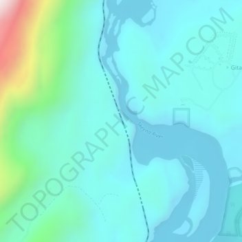
Name: Kitselas Canyon topographic map, elevation, terrain.
Average elevation: 193 m
Minimum elevation: 64 m
Maximum elevation: 886 m
Other topographic maps
Click on a map to view its topography, its elevation and its terrain.
Kleanza Creek Provincial Park
Canada > British Columbia > Gitaus
Kleanza Creek Provincial Park, Kleanza Park Drive, Gossen Subdivision, Gitaus, Regional District of Kitimat-Stikine, British Columbia, Canada
Average elevation: 315 m