
Bad Ischl topographic map
Interactive map
Click on the map to display elevation.
About this map
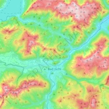
Name: Bad Ischl topographic map, elevation, terrain.
Location: Bad Ischl, Bezirk Gmunden, Upper Austria, 4820, Austria (47.65466 13.51694 47.81500 13.77934)
Average elevation: 926 m
Minimum elevation: 424 m
Maximum elevation: 1,846 m