
Tokat Merkez topographic map
Interactive map
Click on the map to display elevation.
About this map
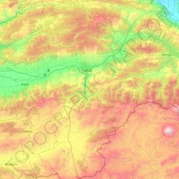
Name: Tokat Merkez topographic map, elevation, terrain.
Location: Tokat Merkez, Tokat, Black Sea Region, Turkey (39.93988 36.32698 40.55845 36.90614)
Average elevation: 1,217 m
Minimum elevation: 275 m
Maximum elevation: 2,536 m
Other topographic maps
Click on a map to view its topography, its elevation and its terrain.