
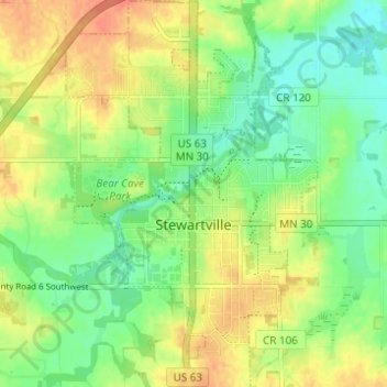
Stewartville topographic map
Interactive map
Click on the map to display elevation.
About this map
Name: Stewartville topographic map, elevation, terrain.
Average elevation: 375 m
Minimum elevation: 354 m
Maximum elevation: 398 m
Other topographic maps
Click on a map to view its topography, its elevation and its terrain.
Carey Creek
United States > Minnesota > Olmsted County
Carey Creek, Olmsted County, Minnesota, 55976, United States
Average elevation: 375 m
Byron
United States > Minnesota > Olmsted County
Byron, Olmsted County, Minnesota, 55920, United States
Average elevation: 365 m
Mayo Lake
United States > Minnesota > Olmsted County > Rochester
Mayo Lake, Rochester, Olmsted County, Minnesota, United States
Average elevation: 336 m
Rochester
United States > Minnesota > Olmsted County
Rochester, Olmsted County, Minnesota, United States
Average elevation: 354 m