
Woodland Beach topographic map
Interactive map
Click on the map to display elevation.
About this map
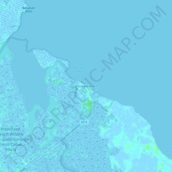
Name: Woodland Beach topographic map, elevation, terrain.
Location: Woodland Beach, Kent County, Delaware, United States (39.31345 -75.49464 39.35345 -75.45464)
Average elevation: 0 m
Minimum elevation: -7 m
Maximum elevation: 8 m
Other topographic maps
Click on a map to view its topography, its elevation and its terrain.
Carriage Lane
United States > Delaware > Kent County
Carriage Lane, Kent County, Delaware, 19962, United States
Average elevation: 10 m
Windy Way
United States > Delaware > Kent County
Windy Way, Kent County, Delaware, 19977, United States
Average elevation: 10 m
Harrington
United States > Delaware > Kent County
Harrington, Kent County, Delaware, United States
Average elevation: 17 m