
Khalkhal topographic map
Interactive map
Click on the map to display elevation.
About this map
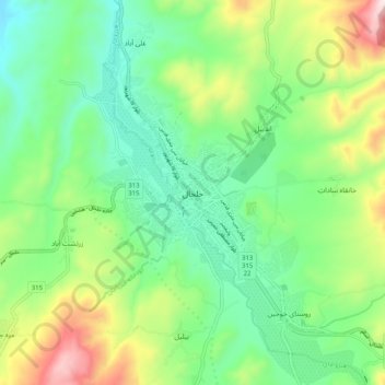
Name: Khalkhal topographic map, elevation, terrain.
Location: Khalkhal, Kahlkhal County, Ardabil Province, Iran (37.57922 48.48781 37.65922 48.56781)
Average elevation: 1,906 m
Minimum elevation: 1,690 m
Maximum elevation: 2,371 m