
Higashimatsushima topographic map
Interactive map
Click on the map to display elevation.
About this map
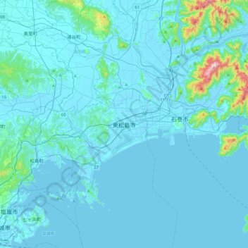
Name: Higashimatsushima topographic map, elevation, terrain.
Location: Higashimatsushima, Miyagi Prefecture, 981-0503, Japan (38.26639 141.05105 38.58639 141.37105)
Average elevation: 27 m
Minimum elevation: -4 m
Maximum elevation: 459 m