
Melfa topographic map
Interactive map
Click on the map to display elevation.
About this map
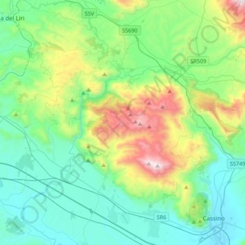
Name: Melfa topographic map, elevation, terrain.
Location: Melfa, Casalattico, Frosinone, Lazio, 03038, Italy (41.50059 13.59326 41.66235 13.89843)
Average elevation: 423 m
Minimum elevation: 30 m
Maximum elevation: 1,658 m
The source of the Melfa issues from a high limestone chimney in the Valle di Canneto at an elevation of 1,020 metres (3,350 ft) in the Lazio watershed of the Parco Nazionale d'Abruzzo, Lazio e Molise beneath the Massiccio del Meta, in the territory of Settefrati. The source has been linked in local legend and popular devotion since Antiquity. In a series of rapids and cascades, it descends the Valle di Comino, passing through Picinisco, Atina— where it receives the waters of the little Mollarino— Casalattico and Casalvieri. Below Casalvieri it passes for 15 km through a deep gorge in the foothills of Monte Cairo at the end of which it reaches the Liri, near Roccasecca.