
Horn Lake topographic map
Interactive map
Click on the map to display elevation.
About this map
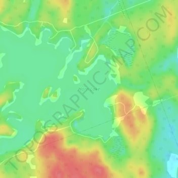
Name: Horn Lake topographic map, elevation, terrain.
Average elevation: 345 m
Minimum elevation: 318 m
Maximum elevation: 381 m
Other topographic maps
Click on a map to view its topography, its elevation and its terrain.
Ahmic Lake
Canada > Ontario > Magnetawan
Ahmic Lake, Magnetawan, Parry Sound District, Central Ontario, Ontario, Canada
Average elevation: 296 m
Lake Cecebe
Canada > Ontario > Magnetawan
Lake Cecebe, Magnetawan, Parry Sound District, Central Ontario, Ontario, Canada
Average elevation: 296 m
Manitouwabing River
Canada > Ontario > Magnetawan
Manitouwabing River, Magnetawan, Parry Sound District, Central Ontario, Ontario, Canada
Average elevation: 303 m
Ogden Lake
Canada > Ontario > Magnetawan
Ogden Lake, North Whalley Lake Road, Magnetawan, Parry Sound District, Central Ontario, Ontario, P0A 1P0, Canada
Average elevation: 317 m