
Sanda topographic map
Interactive map
Click on the map to display elevation.
About this map
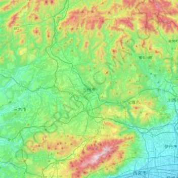
Name: Sanda topographic map, elevation, terrain.
Location: Sanda, Hyogo Prefecture, 669-1518, Japan (34.72899 135.06846 35.04899 135.38846)
Average elevation: 266 m
Minimum elevation: 0 m
Maximum elevation: 911 m