
Höörs kommun topographic map
Interactive map
Click on the map to display elevation.
About this map
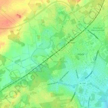
Name: Höörs kommun topographic map, elevation, terrain.
Location: Höörs kommun, Skåne County, Region Götaland, 243 31, Sweden (55.93328 13.53328 55.93338 13.53338)
Average elevation: 80 m
Minimum elevation: 60 m
Maximum elevation: 103 m