
Pathein topographic map
Interactive map
Click on the map to display elevation.
About this map
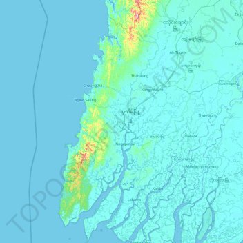
Name: Pathein topographic map, elevation, terrain.
Location: Pathein, Ayeyarwady, Myanmar (15.83215 94.19115 17.57306 95.43331)
Average elevation: 12 m
Minimum elevation: -4 m
Maximum elevation: 517 m
Other topographic maps
Click on a map to view its topography, its elevation and its terrain.