
Falls Lake topographic map
Interactive map
Click on the map to display elevation.
About this map
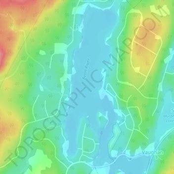
Name: Falls Lake topographic map, elevation, terrain.
Average elevation: 126 m
Minimum elevation: 99 m
Maximum elevation: 189 m
Other topographic maps
Click on a map to view its topography, its elevation and its terrain.
Armstrong Lake
Canada > Nova Scotia > Hants County > Vaughan
Armstrong Lake, Vaughan, Region of Windsor and West Hants Municipality, Hants County, Nova Scotia, B0N 2T0, Canada
Average elevation: 177 m