
Ribadesella topographic map
Interactive map
Click on the map to display elevation.
About this map
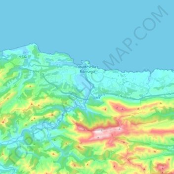
Name: Ribadesella topographic map, elevation, terrain.
Location: Ribadesella, Asturias, 33560, Spain (43.40671 -5.19316 43.48468 -4.98138)
Average elevation: 153 m
Minimum elevation: -5 m
Maximum elevation: 886 m