
Lethbridge topographic map
Interactive map
Click on the map to display elevation.
About this map
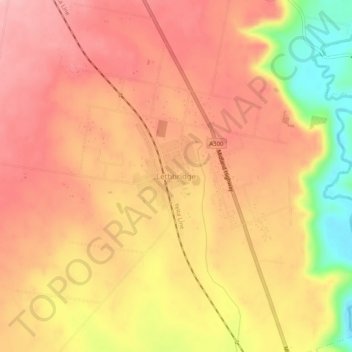
Name: Lethbridge topographic map, elevation, terrain.
Location: Lethbridge, Golden Plains Shire, Victoria, 3332, Australia (-37.98723 144.11314 -37.94723 144.15314)
Average elevation: 160 m
Minimum elevation: 66 m
Maximum elevation: 206 m