
Charlottetown topographic map
Interactive map
Click on the map to display elevation.
About this map
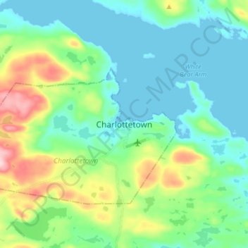
Name: Charlottetown topographic map, elevation, terrain.
Location: Charlottetown, Labrador, Newfoundland and Labrador, Canada (52.73194 -56.15874 52.81194 -56.07874)
Average elevation: 57 m
Minimum elevation: -6 m
Maximum elevation: 229 m